All currently available INPULS Level‑3 products covering trace gases as well as cloud information are available through the EOC Geoservice.
The EOC Geoservice Frontend (see Figure 1) offers intuitive access to all INPULS iL3 and iL4 products. In addition, the EOC Geoservice also offers access through the OGC-compliant APIs “Web Map Service - Time” (WMS‑T) and “Web Coverage Service” (WCS). All pure (original) iL3 and iL4 datafiles from the INPULS project will also be disseminated via the EOC Download service. Of course, each INPULS product type (= collection) will become searchable through an individual Digital Object Identifier (DOI).
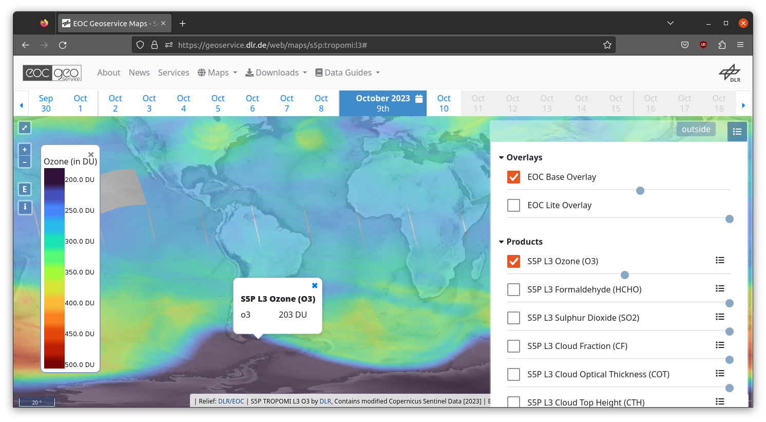 Figure 1: Access by the EOC Geoservice Frontend.
STAC metadata are generated for all INPULS iL3 and iL4 products. STAC stands for SpatioTemporal Asset Catalogue. STAC is the state-of-the-art standard to make datasets easily findable with respect to geospatial search queries (searching for bounding boxes and periods).
STAC supports human-readable exploration of collections and individual products as well as programmatic access via the identical interfaces.
So the EOC STAC catalogue enables efficient spatiotemporal data analytics: Server-side data interpolation and data slicing on the basis of Cloud Optimized GeoTIFFs minimize the amount of data to be transferred to the clients (–> “bring the algorithm to the data”).
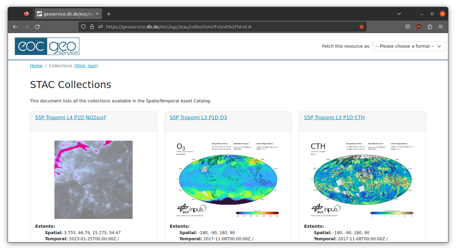 Figure 2: STAC interface (html) for exploration of available
data collections.
Figure 2: STAC interface (html) for exploration of available
data collections.
Jupyter Notebooks (Python) to illustrate the usage of the EOC STAC interface and the interpolation capabilities of the EOC Download Service are provided here:
- Ozone Hole Size derived from S5P‑L3 O3
- Correlate building heights with surface NO2 (product: S5P L4‑NO2, S5P‑NO2 assimilated into air quality model POLYPHEMUS/DLR
- openEO: Analysis of ozone maximum with respect to latitude
- Correlate stratospheric temperature with S5P‑L3 Ozone VCD
- Correlate surface NO2 (L4 product) with World Settlement Footprint (WSF)
- EUMETSAT Conference 2025: Surface NO2 and World Settlement Footprint
All available innovative Level‑3 products from Sentinel‑5P, Sentinel‑4 and Sentinel‑5 are available via EOC Geoservice’s STAC interface.
Contact
Julian Meyer‑Arnek, DLR DFD‑INF